
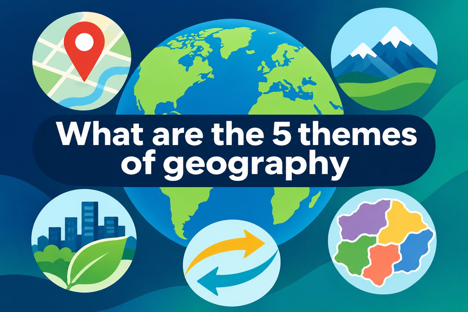
Geography is more than learning place names or locating countries on a map. The five themes of geography give students, teachers, and curious readers a simple way to explore how the world works. They help explain where places are, what they are like, how people use them, how people move, and how different areas are connected. Whether you are studying a local neighborhood, a distant country, or a current event, these themes turn basic facts into meaningful questions. In this guide, you will learn the meaning of each theme, see practical examples, avoid common mistakes, and discover how to use the five themes of geography in everyday learning.
Why the Five Themes of Geography Matter
The five themes provide a clear framework for studying both physical landscapes and human societies. Instead of viewing geography as a list of isolated facts, readers can investigate relationships between people, places, environments, and movement.
They also build useful thinking skills. A student can ask why a city developed beside a river, how climate influences farming, or why goods travel through certain routes. These questions connect geography to history, science, economics, culture, and daily life.
The Five Themes of Geography Explained
1. Location
Location tells us where a place is. It can be described in two main ways: absolute location and relative location. Absolute location uses exact coordinates, such as latitude and longitude. Relative location explains where something is compared with another place, such as saying a town is north of a capital city or near a mountain range.
2. Place
Place describes the features that make an area unique. These features can be physical, including landforms, weather, plants, and water. They can also be human, including language, architecture, traditions, food, and population. Place helps us recognize why one location feels different from another.
3. Human-Environment Interaction
Human-environment interaction examines how people depend on, adapt to, and change their surroundings. People rely on natural resources for food, water, energy, and shelter. At the same time, they build roads, farm land, manage rivers, and create cities, all of which affect the environment.
4. Movement
Movement focuses on how people, products, information, and ideas travel from one place to another. Migration, trade, tourism, shipping, communication, and digital media all fit within this theme. Movement shows that places are connected rather than isolated.
5. Region
A region is an area with shared characteristics. These characteristics may be physical, cultural, economic, political, or social. For example, a desert region may share a dry climate, while a language region may include places where people speak the same language.
Location in Geography
Location is often the starting point for geographic study because it answers the basic question, “Where is it?” Yet a strong explanation goes beyond pointing to a spot on a map. It considers why the location matters and what opportunities or limits it creates.
1. Absolute Location
Absolute location gives a precise position using coordinates. Latitude measures distance north or south of the Equator, while longitude measures distance east or west of the Prime Meridian. This method is useful for navigation, mapping, emergency response, and scientific research because it identifies one exact point.
2. Relative Location
Relative location places an area in context. A city might be described as being near a coast, beside a major highway, or between two larger cities. This description can change depending on the purpose of the discussion, but it often explains trade, travel, climate, and cultural connections more clearly.
3. Site and Situation
Geographers sometimes distinguish between a site and a situation. Site refers to the physical features of the actual location, such as soil, elevation, water supply, or natural harbor. Situation refers to how that location relates to surrounding places, transport routes, and regions.
4. Location and Opportunity
A location can create advantages. Coastal cities often gain access to ports and trade routes, while areas near fertile rivers may support agriculture. Locations near railways, airports, or major roads can also become centers for business, tourism, and population growth.
5. Location and Risk
Location can also bring challenges. Communities near fault lines may face earthquakes, while coastal communities may be vulnerable to storms and flooding. Understanding location helps people plan safer buildings, emergency services, and land use decisions.
6. Using Maps Carefully
Maps are valuable tools, but they do not show every detail. Scale, projection, labels, and symbols influence what a map communicates. When studying location, compare different maps and ask what information is included, what is missing, and why the map was created.
Place and Geographic Identity
Place gives geography its human and physical character. Two locations may sit at similar latitudes yet look, feel, and function very differently because their environments and cultures have developed in distinct ways.
1. Physical Characteristics
Physical characteristics include climate, landforms, soils, vegetation, wildlife, and natural resources. A mountainous area may have steep slopes and cooler temperatures, while a tropical coast may have warm weather, beaches, and dense vegetation. These features influence settlement and work.
2. Human Characteristics
Human characteristics are created or shaped by people. They include buildings, roads, languages, religions, customs, government systems, art, and local industries. A place may be known for historic neighborhoods, a major university, fishing traditions, or manufacturing.
3. Sense of Place
Sense of place is the meaning people attach to an area. Residents may feel connected to a neighborhood because of family history, shared traditions, natural beauty, or familiar public spaces. This personal connection can influence how people protect, describe, and develop their communities.
4. Changing Places
Places do not stay the same forever. New residents, businesses, technologies, and environmental events can alter an area’s appearance and identity. A rural town may become a tourist destination, or an industrial district may become a residential neighborhood over time.
5. Comparing Places
Comparing places helps learners notice both differences and similarities. For instance, two farming communities may grow different crops because of climate and soil, but both may rely on seasonal labor and transport networks. Good comparisons explain the causes behind the patterns.
6. Avoiding Stereotypes
A place should never be reduced to one image or assumption. Countries, regions, and cities contain many communities, landscapes, and experiences. Use reliable details and recognize diversity within every place instead of treating a single feature as the whole story.
Human-Environment Interaction in Daily Life
This theme shows that people and nature constantly influence one another. It is especially useful for studying sustainability, natural hazards, resource use, and community planning.
1. Depending on Natural Resources
People depend on land, water, forests, minerals, sunlight, and energy sources. Farmers need soil and rainfall, while cities need reliable water and power systems. Geography helps explain how resource availability affects settlement patterns, jobs, and quality of life.
2. Adapting to Conditions
Adaptation means adjusting to environmental conditions. People in cold regions may design insulated homes and use heating systems, while people in hot, dry areas may conserve water and build structures that provide shade. Adaptation does not remove every risk, but it helps communities live more safely.
3. Modifying Landscapes
Humans modify environments through farming, construction, mining, irrigation, and transportation systems. These changes can improve access to food, housing, and services, but they can also create erosion, pollution, habitat loss, or flood risk if planning is poor.
4. Responding to Hazards
Earthquakes, floods, wildfires, droughts, and storms affect communities differently depending on location, resources, and preparation. Geographic thinking helps people identify vulnerable areas, improve warning systems, and make practical choices before and after a disaster.
5. Supporting Sustainability
Sustainability means meeting current needs without damaging future opportunities. It can involve saving water, protecting soil, reducing waste, improving public transport, and using energy efficiently. The human-environment interaction theme encourages people to consider long-term effects, not only short-term convenience.
6. Seeing Different Perspectives
Environmental decisions often involve trade-offs. A dam may provide water and electricity but also change river habitats and affect nearby communities. A thoughtful geographic analysis considers the benefits, costs, and viewpoints of people who are affected by the decision.
Movement and Global Connections
Movement explains how connections form between places. It includes visible travel, such as shipping and migration, as well as less visible flows of money, information, culture, and technology.
1. Movement of People
People move for many reasons, including work, education, safety, family, climate, and opportunity. Some moves are temporary, while others are permanent. Studying migration requires care because every movement story includes personal choices, wider conditions, and possible challenges.
2. Movement of Goods
Products often travel long distances before reaching consumers. Food, clothing, electronics, and fuel may be produced in one region, processed in another, and sold elsewhere. Trade routes, ports, roads, railways, and airports make these connections possible.
3. Movement of Ideas
Ideas travel through education, conversation, books, media, and digital communication. Music, fashion, language, scientific knowledge, and political ideas can spread quickly across borders. However, places often adapt outside influences to fit local traditions and needs.
4. Transportation Networks
Transportation networks shape where people live and where businesses grow. A new highway, train line, or airport can improve access to jobs and markets. It can also change traffic patterns, land values, and environmental conditions in nearby communities.
5. Communication Technology
Modern communication allows information to move almost instantly. Remote work, online learning, news, and social communities connect people across long distances. Geography still matters, though, because internet access, language, time zones, and local infrastructure are not equal everywhere.
6. Cultural Exchange
Movement creates cultural exchange when people share food, art, beliefs, skills, and customs. This exchange can enrich communities, but it should be approached respectfully. Learning where traditions come from and how communities value them prevents shallow or inaccurate interpretations.
Regions and Shared Characteristics
Regions make large amounts of geographic information easier to organize. They help people identify patterns without losing sight of the fact that boundaries can be flexible and change over time.
1. Formal Regions
A formal region has a clear shared feature, such as a political boundary, a climate zone, or an official language. A state, country, or school district can be a formal region because it has defined borders and a common administrative structure.
2. Functional Regions
A functional region is organized around a central point or activity. A city and its commuting area form a functional region because workers, services, and transportation connect surrounding communities to the urban center. Broadcast and delivery areas can work similarly.
3. Perceptual Regions
A perceptual region is based on how people think about an area. Terms such as “the Midwest” or “the countryside” may have broad meanings, but their exact boundaries can differ from person to person. These regions still matter because they shape identity and decision-making.
4. Physical Regions
Physical regions are grouped by natural features such as climate, mountains, rivers, vegetation, or soils. A rainforest region, coastal plain, or alpine area can be studied as a physical region because environmental conditions create recognizable patterns.
5. Cultural Regions
Cultural regions share traits such as language, religion, food, heritage, or artistic traditions. They may cross political borders because culture does not always follow official lines. Care is needed to recognize the variety of experiences within any cultural region.
6. Economic Regions
Economic regions are connected by work, trade, industries, or resources. An agricultural belt, technology corridor, or mining area may develop shared economic patterns. These patterns can affect housing, population, transport, education, and environmental decisions.
Practical Ways to Use the Five Themes
The five themes are useful far beyond a classroom worksheet. They offer a repeatable method for investigating a place, planning a project, or interpreting a news story.
1. Start With Location
Find the place on a map and identify both its absolute and relative location. Ask what lies nearby, what natural features surround it, and how its position affects travel, weather, trade, or safety.
2. Describe the Place
List physical and human characteristics. Consider landscape, climate, resources, buildings, population, language, and traditions. Choose details that explain what makes the place distinct rather than collecting random facts.
3. Explore Human-Environment Interaction
Ask how people use local resources, adapt to natural conditions, and change the landscape. Look for both positive outcomes and possible problems, such as conservation successes, water shortages, pollution, or disaster preparation.
4. Trace Movement
Identify what moves into, out of, and through the area. This could include workers, visitors, goods, information, cultural influences, or wildlife. Then consider which roads, ports, networks, or systems enable that movement.
5. Identify Relevant Regions
Decide which regions the place belongs to. It may fit into a political region, climate zone, cultural area, economic network, or metropolitan region at the same time. Each regional view reveals a different pattern.
6. Ask Cause-And-Effect Questions
Move beyond description by asking why patterns exist. Why do people settle in one area rather than another? Why is a product grown there? Why does a hazard affect one group more severely? These questions lead to stronger geographic explanations.
7. Use Evidence
Support conclusions with maps, observations, reliable data, photographs, and firsthand accounts when appropriate. Evidence should match the question being asked. A climate map may explain rainfall patterns, while population data may help explain urban growth.
Common Mistakes to Avoid
1. Treating The Themes As Separate Boxes
The themes overlap constantly. Location affects movement, environment shapes place, and regions are influenced by culture and economy. Avoid forcing a fact into only one theme when it clearly connects to several.
2. Memorizing Without Explaining
Remembering definitions is useful, but it is not the final goal. A strong answer explains relationships and consequences. Instead of saying a city is near a river, explain how the river may support transport, farming, water supply, or flood risk.
3. Confusing Place With Location
Location answers where something is, while place explains what it is like. Keep the distinction clear. Coordinates and nearby landmarks fit location, while climate, culture, architecture, and natural features help describe place.
4. Ignoring Time
Geography changes. Population, land use, climate conditions, transport routes, and regional identities can shift over years or decades. Include a time frame when it matters, especially when discussing development, environmental change, or migration.
5. Using Broad Assumptions
Do not assume everyone in a region has the same lifestyle, belief, income, or experience. Geographic patterns are useful, but people and communities are diverse. Precise language creates a more respectful and accurate analysis.
6. Forgetting Human Choices
Environmental conditions influence people, but they do not determine every outcome. Laws, technology, culture, wealth, planning, and cooperation also shape what communities can do. Geography should explain influences without suggesting that people have no agency.
Frequently Asked Questions
1. What Are The Five Themes Of Geography?
The five themes of geography are location, place, human-environment interaction, movement, and region. Together, they provide a practical framework for studying where things are, what makes places unique, how people affect environments, how connections form, and how areas are grouped.
2. Who Created The Five Themes Of Geography?
The framework was developed in the United States by geography education organizations to make geographic learning clearer and more consistent. It became widely used in schools because the themes give students an easy structure for asking meaningful questions about people, places, and environments.
3. Are The Five Themes Still Useful Today?
Yes. Although geography also uses newer frameworks and more specialized methods, the five themes remain a helpful introduction. They are especially useful for organizing research, discussing current events, comparing places, and helping learners connect physical geography with human activity.
4. What Is The Difference Between Location And Place?
Location tells where something is, either exactly through coordinates or relatively through nearby features. Place describes the characteristics that make an area distinctive, including physical features such as climate and landforms, plus human features such as culture, buildings, and activities.
5. Can One Example Fit More Than One Theme?
Yes. A port city beside a river involves location because of its position, place because of its physical and cultural features, movement because goods and people travel through it, and human-environment interaction because development affects the waterfront. The themes are designed to connect.
6. How Can Students Remember The Five Themes?
Students can remember them by asking five questions about any area: Where is it? What is it like? How do people and nature affect each other there? What moves to and from it? What larger region or regions does it belong to? Practice makes the framework familiar.
Conclusion
The five themes of geography provide a simple but powerful way to study the world. Location identifies where a place is, place describes its character, human-environment interaction examines shared influence, movement traces connections, and region groups places by meaningful patterns.
When used together, these themes encourage better questions instead of simple memorization. They help readers see how landscapes, communities, resources, and ideas are connected. Whether you are studying a hometown or a distant part of the world, the framework makes geography more practical, thoughtful, and relevant.
Discussion